This High-Altitude Colorado Drive Offers Some of the Most Stunning Views in the Rockies
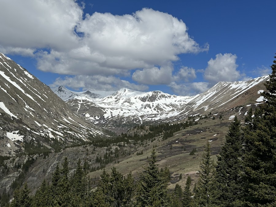
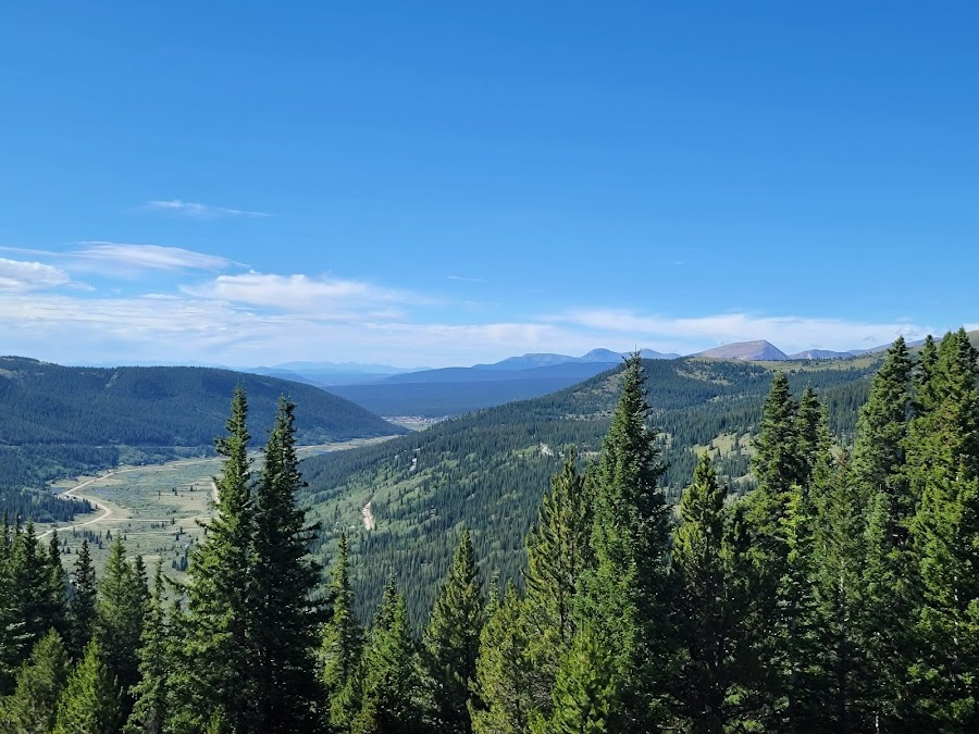
You wouldn’t expect the road ahead to feel like a sweeping postcard—one moment you’re framed by spruce and aspen, the next you’re staring down a sheer drop toward a river canyon that seems impossibly far below. That sudden expansiveness, the breath-catching verticality, tends to sneak up on first-timers.
Then there’s the odd quiet: in spite of being a public pass on a state highway, certain stretches feel possessed—like you’re floating above the world, with only wind and distant peaks for company. On a clear day, the ridgelines ripple into the horizon, the sky seems impossibly blue, and the air is so thin it reminds you you’re in a different realm.
Google maps
That place? It’s called Hoosier Pass—a high mountain pass (over 11,500 feet) on State Highway 9 between Fairplay and Breckenridge. It’s not a lodge, not a bar, not even a restaurant—it’s a route, a scenic access point, and a trailhead hub all rolled into one, lending visitors panoramic views, alpine air, and gateway access to hikes, photos, and fresh mountain time.
What We Love
Continental Divide Moment
At the summit, a sign marks the Continental Divide—stand there and imagine raindrops on one side flowing to the Atlantic, on the other toward the Pacific. It’s a quietly profound moment, especially when the wind picks up and you feel the spine of the continent beneath your feet.
Google maps
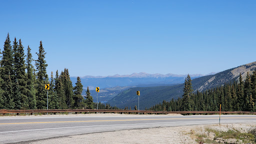
Switchbacks That Thrill (But Don’t Terrify)
The drive includes some sharp turns, especially on the Breckenridge side, but it’s never so intense you can’t handle it. For most drivers comfortable in the mountains, the twists add personality and occasional “whoa, that view” surprises.
Google maps
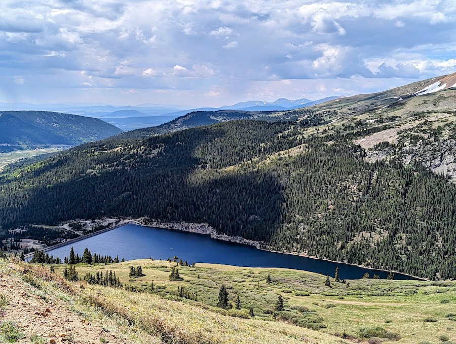
Trailhead Variety
Right from the pass there are trails of differing lengths: the Hoosier Pass Loop (≈ 2.8 miles, ~688 ft gain) is a sweet moderate option, while ambitious hikers can use the pass as a launching pad toward Hoosier Ridge or climb nearby peaks.

Google maps
Year-Round Access (With Warnings)
In ideal conditions, you can drive through most of the year—though winter storms sometimes close the road. When open, the panorama is spectacular whether you arrive in sun or snow.
Google maps
Quiet Pull-Offs for Solitude
You’ll find small turnout areas where you can stop, step out, stretch, take photos, and just listen. In the early morning or late afternoon, you may find yourself alone, wrapped in alpine silence.
Google maps
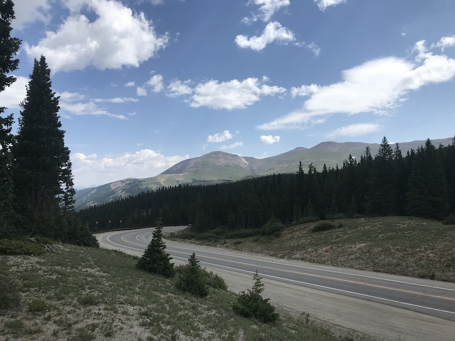
Atmosphere & Setting
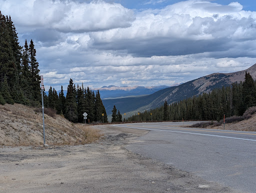
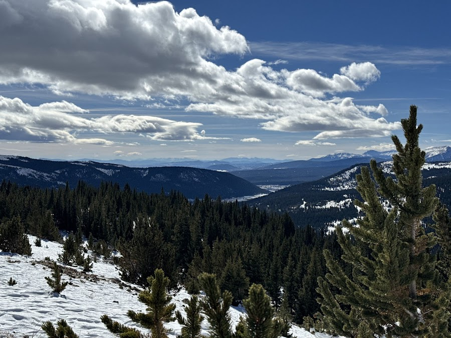
Driving up, you ascend through a forested corridor, the trees thinning as you climb. When you break above the tree line, the landscape opens abruptly: rugged slopes, craggy ridges, scree patches, and mountain meadows. The colors shift from deep greens to pale grays and golds (especially in fall, when aspens flash). The sky feels higher here—vast, buoyant, and deeply blue. On clear days, far peaks draw the eye in layered blues and purples. The pass’s summit parking area is modest—just enough space to park, wander, and absorb the views. Wind often hums or sighs; when vehicles pass, the sound briefly intrudes, then fades. The space flows from road to vista to trailhead seamlessly: no barriers, just transitions from car to nature.
Google maps
Value (Is It Worth It?)
There’s no admission cost—you’re driving a public highway. The “price” is your time, fuel, and willingness to acclimate to altitude. Most people spend 30 minutes up to a few hours here, depending on whether they hike or just stop for photos. For adventurers and road-trippers alike, it’s absolute time well spent—especially for those staying in or passing through the region. It’s best for travelers who love vistas, gentle to moderate hiking, and scenic drives; less ideal for people looking for amenities or family-friendly attractions with restrooms and cafés.
Google maps
Other Considerations
Because you’re already at high elevation, take things slowly at first if you live low. Hydrate, rest a moment, and watch for altitude effects. The pass is sometimes closed during winter storms—check road conditions before heading up. Some sections on the north side include steep grades and tighter turns, so cautious driving is wise. There are few services at the pass itself, so fuel, snacks, or restrooms should be handled before or after. Parking at trailheads can fill quickly during summer weekends, and some hiking trails closer to Breckenridge require shuttle or reservation during peak season. Also keep in mind that cell reception is spotty.
Google maps
Whether you’re on a mountain-town getaway, a road-trip loop, or just chasing views, Hoosier Pass offers a slice of Colorado’s wild openness that sticks with you long after you leave. It’s one of those places you conjure in memory when you think “mountain time.”
Hoosier Pass
📍 State Highway 9, Breckenridge / Fairplay corridor, Colorado